
► User manuals for Little Navmap and Little Navconnect in all formats and languages.
- Little Navmap is a free open source flight planner, navigation tool, moving map, airport search and airport information system.
- Supported platforms: Windows 7/8/10, macOS (10.10 or newer only) and Linux (64 bit only).
- Support for Flight Simulator X, Flight Simulator - Steam Edition, Prepar3D v2, v3, v4 and X-Plane 11 (64 bit).
- Comes with the following user interface languages: Dutch, Brazilian Portuguese, French, Spanish, Italian and German (Spanish and Italian being work in progress).
- All is based on flight simulator stock or add-on data, no third party data needed. All stock and add-on airports are loaded in a few minutes.
- Navigation data can be updated from Navigraph. A cycle 1801 database courtesy of navigraph is included in the download and includes navaids, airways, airspaces and procedures.
- Navigation database updates by fsAerodata and FSX/P3D Navaids update are supported. Support for X-Plane navdata updates and user defined waypoints.
- Can read airspaces in OpenAir format for X-Plane and FSX or Prepar3D airspaces can be copied into the X-Plane database.
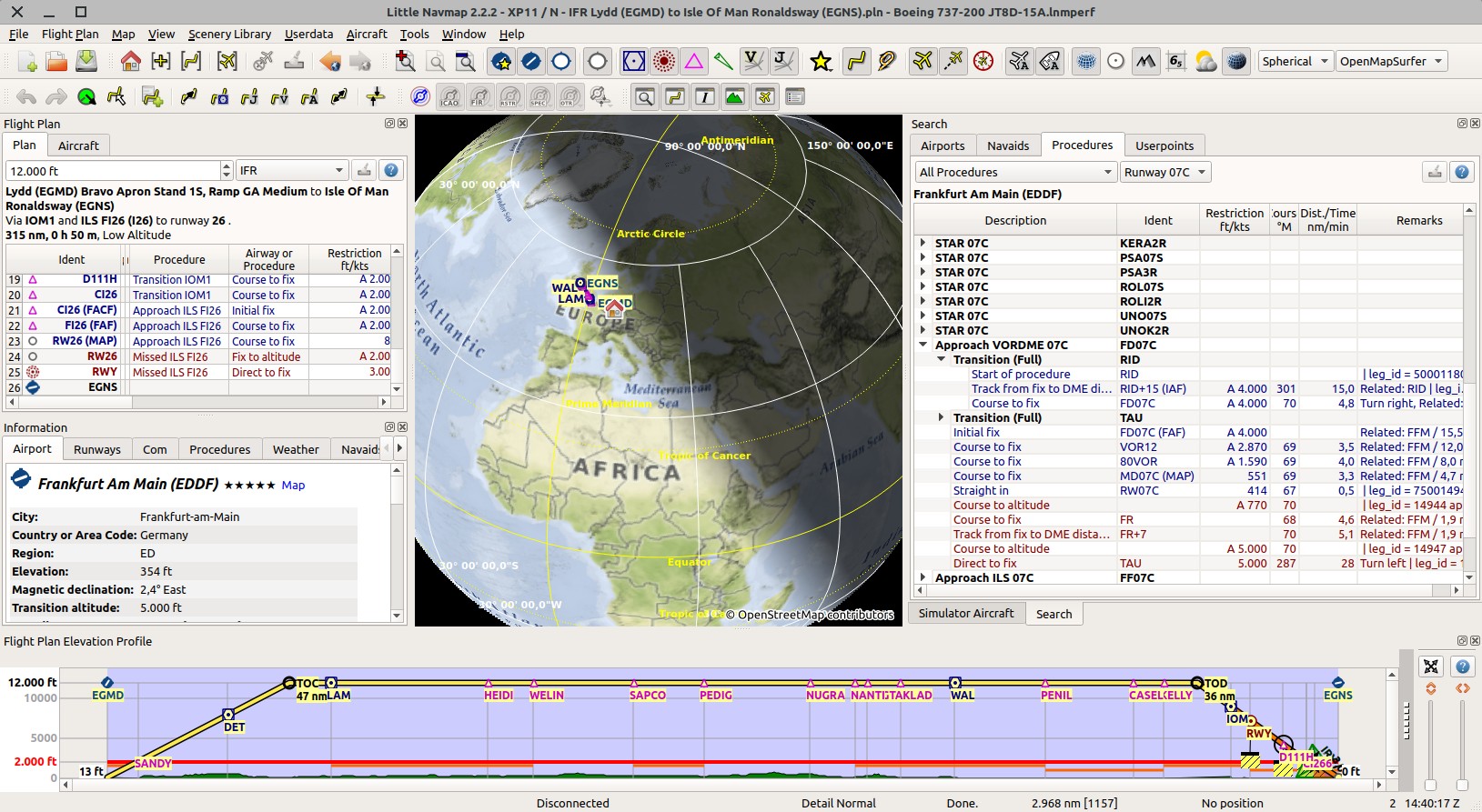
- Uses X-Plane stock and updated navdata for approach, SID and STAR procedures including transitions.
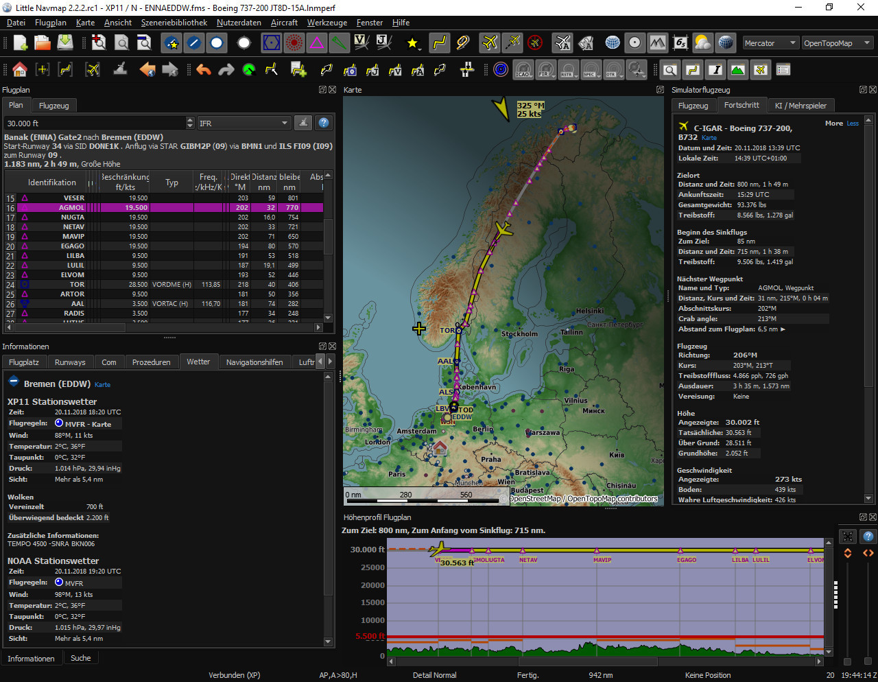
- It features a detail rich navigation map that partially uses symbols from real VFR maps thus transporting a large amount of information. Multiple offline maps, online map themes (OpenStreetMap, OpenTopoMap, OpenMapSurfer and more) and two map projections are available. Several map themes provide hill shading as well as display of the sun shadow on the globe.
- Quick modifier mouse clicks in map allow fast actions.
E.g.
Ctrl+Clickto start measurement orShift+Clickto place range rings. - The map shows user and AI aircraft as well as ships, airports, airport maps (runway details, overrun areas, displaced thresholds, taxiways and more), VOR, VORTAC, TACAN, NDB, ILS, waypoints, airways, airspaces, approach and departure procedures, airport weather symbols and minimum off-route altitude grid. Plenty of information is available in tooltips or information windows for each map object.
- Flight plans and flight plan fragments can be loaded, saved and merged all using the common Flight Simulator PLN files as well as X-Plane FMS format version 3 and 11, FSC and FLP files.
- Flight plans can be exported to the Reality XP GNS 530W/430W V2, the Reality XP GTN 750/650 Touch and the Flight1 GTN 650/750.
- More export formats are GPX (GPS Exchange Format, including flown track), PMDG RTE, FLP, X-Plane FMS 3 and 11, Majestic Dash FPR and many more. FS9 PLN and FSC plans can be imported.
- Drag and drop flight plan editing functionality on the map allows to easily create and edit plans.
- Several fast automatic flight plan calculation modes are available to create plans following airways or simply from radio navaid to radio navaid within a split second. No online service is needed for flight plan calculation.
- Option to calculate flight plan fragments between any two waypoints of a present flight plan.
- Flight plan route descriptions can be read which allows to convert flight plans from and to ATS route descriptions which can be retrieved from the various online services like RouteFinder or SkyVector. This includes SIDs, STARs and information for cruise speed and altitude.
- Aircraft performance, fuel planning top of climb and top of descent calculation considering aircraft performance and altitude restrictions in procedures is available.
- A zoom and scrollable elevation profile window shows the ground elevation along the flight plan including the minimum safe altitude for the whole plan or each segment as well as procedure altitude restrictions.
- The map and flight plans including all related information at departure and destination can be printed.
- A fast airport and navaid search allows to look for objects by an unimaginable amount of options also featuring a spatial search to find nearest airports.
- Information windows display numerous details about airports, runways, COM frequencies, approach and departure procedures, navaids, the user aircraft, AI or multiplayer aircraft as well as ships, decoded weather from multiple sources like X-Plane, AS16, Active Sky Next, Active Sky for Prepare3D v4, NOAA, VATSIM and IVAO. Sunrise and sunset for airports is shown in information as well as bearing and distance to user aircraft.
- The map display and the measurement units (nautical, metric, imperial) can be customized by the user.
- User interface and map display can be further customized by changing configuration files and SVG icons.
- All settings, search parameters, current flight plan, map positions and much more are saved between sessions.
- Little Navmap can connect directly to the flight simulator, the Little Xpconnect X-Plane plugin and can also be run stand-alone or in networked configuration.
- Complete functionality for user defined waypoints. Add, edit (also bulk-edit), delete, search, move and display. Allows to create custom categories and icons. Import and export of CSV, X-Plane and Garmin files.
- Optionally creates logbook entries in userdata for each takeoff and landing.
- Can display IVAO, VATSIM and custom online networks centers and clients on map, tooltips and information windows.
IVAO is currently disabled due to missing clearance. Need volunteers to run a mirror. - Compass rose for map or user aircraft showing heading, track and distances.
- Customizable airport traffic patterns can be shown for any airport.
- An automatic reconnect option makes the start order of programs irrelevant. Running a networked setup needs the included Little Navconnect program which eases setup across two or more computers.
- The program does not consume a lot of resources and can be run on low end computers.
- User interface styles (also
Night) can be changed on the fly without restart. - Help is available online (can be downloaded as PDF, ePub or Mobi). A PDF file with the complete manual is included with the program. Help buttons in dialogs link to corresponding online help chapter.
- The program can check for updates on three different channels (stable, beta and develop) and will show a notification if a new version is available. Configurable in options dialog.


