Giter VIP home page Giter VIP logo

atlas's Introduction

Atlas

Atlas is a 3D GIS visualization project that aims to combine some basic features of QGIS and Google Earth. It utilizes osgEarth to handle 2D maps and 3D models in the same space. It depends on Qt 5 to provide an customizable UI and provides a strong plugin system.

The main purpose of the project is to provide fancier and easier visualization of geographic applications, while supporting complicated analysis tasks and more advanced research purposes.

It has been tested on Windows 10, Fedora 28 and ubuntu 16.04.

中文版说明

Features

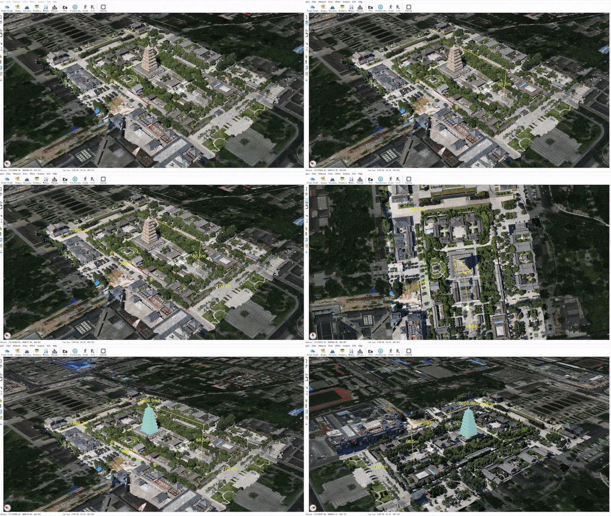
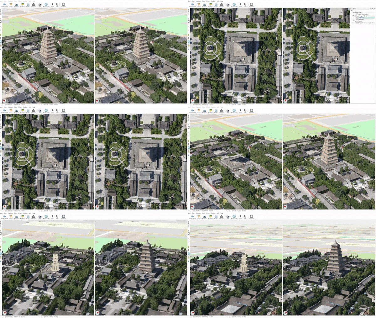
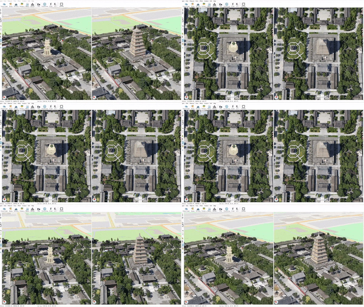
Large Scale 3D Models

Improved performance, interaction, and various analysis and measurement tools for:

Geographic Data

Common geographic data formats and services are supported and fused together in the 3D space.

  • local files: see GDAL raster and GDAL ogr
  • raster services: XYZ tiles, TMS, WMS, ArcGIS services
  • vector services: WFS, ArcGIS services

Coherent Data Api

Atlas provides a high level and uniform api for different data formats supported by OSG, osgEarth and custom plugins. For supported data formats please see:

Highly Extensible

Atlas is built upon plugins. It is easy to add new features to the main program or modify the existing behaviours with the help of plugins.

A full list of current plugins can be found at plugins.md.

Demos

The project is still under development, but a development release is provided so you can have a taste of it.

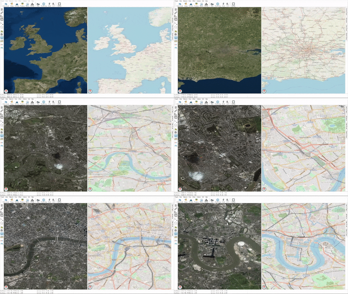
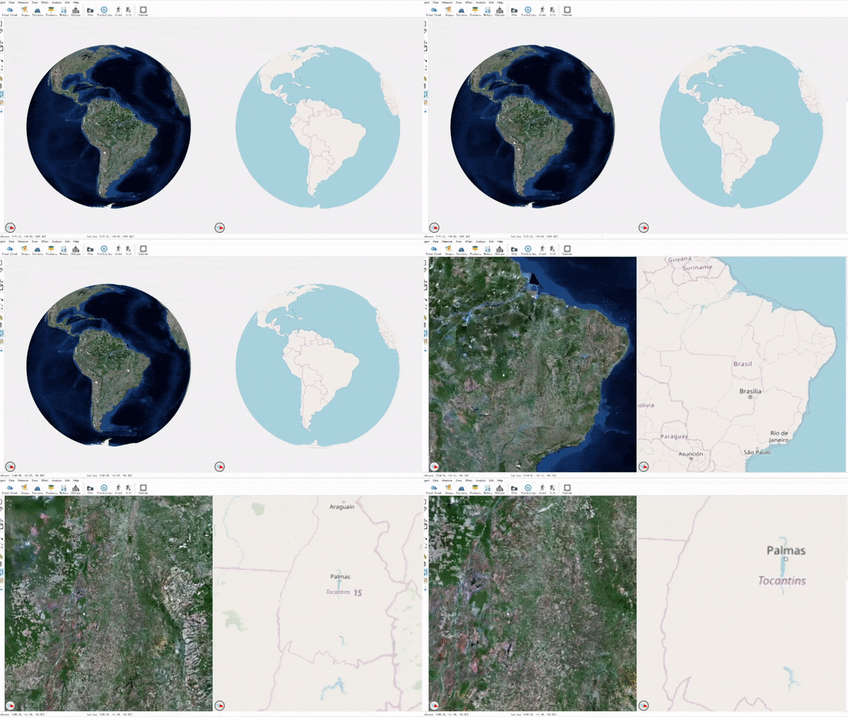
Geodetic & projected modes

image not available

image not available

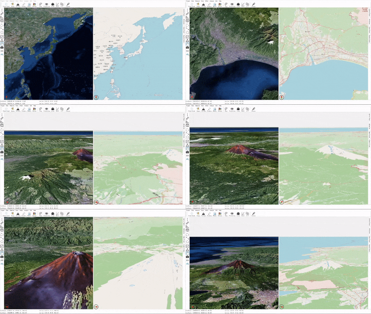
Online images & terrains

image not available

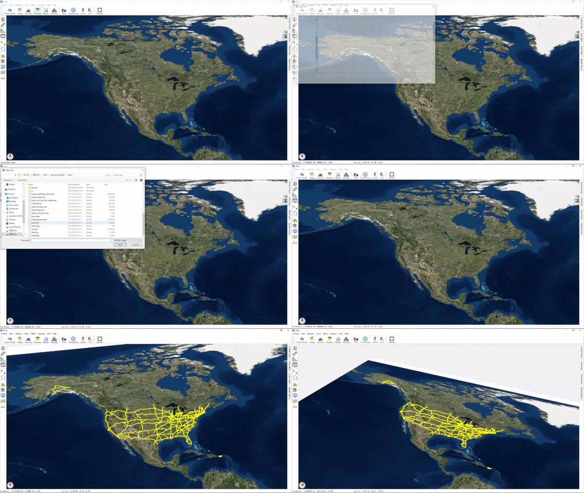
ShapeFile or Geo-features

image not available

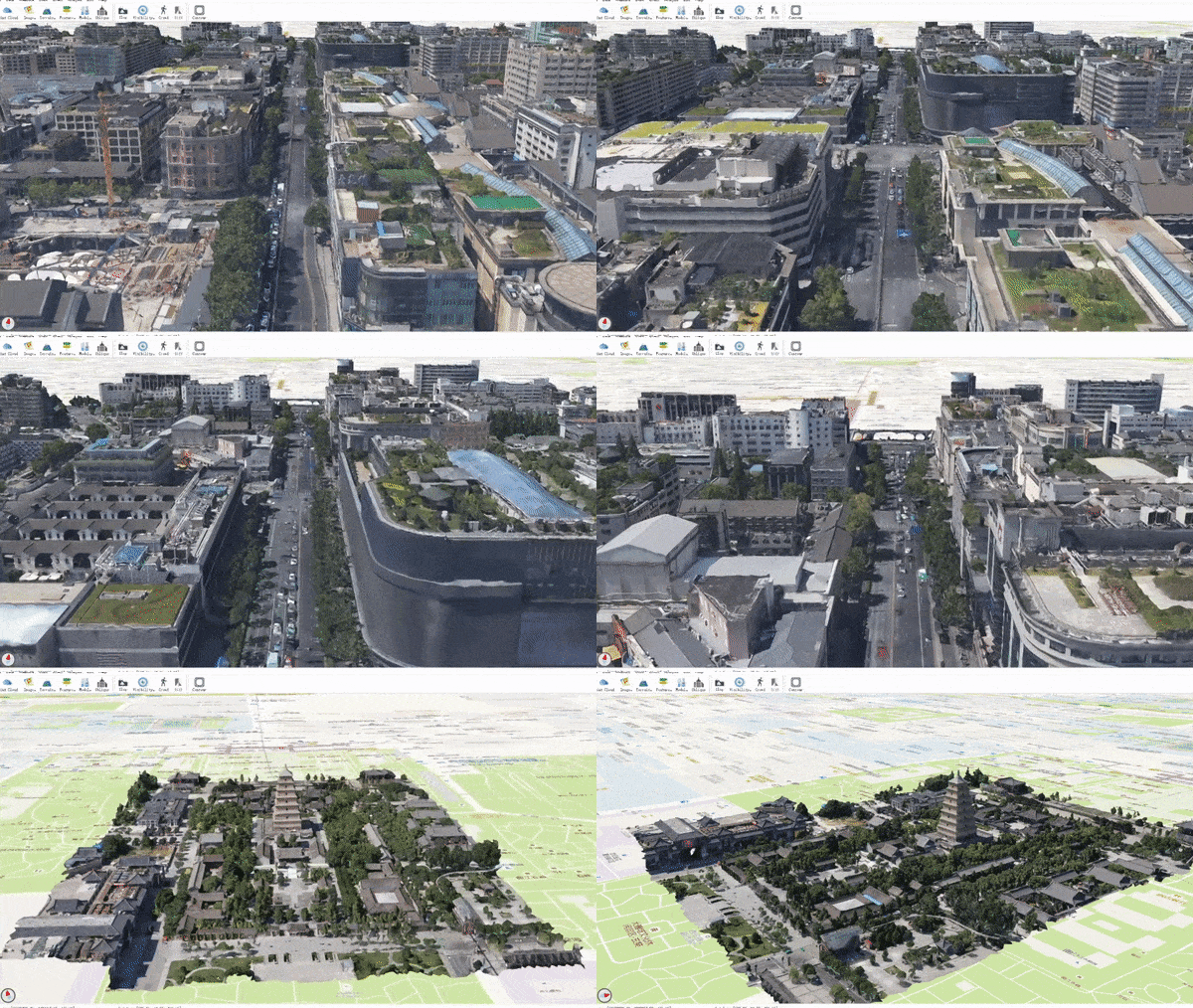
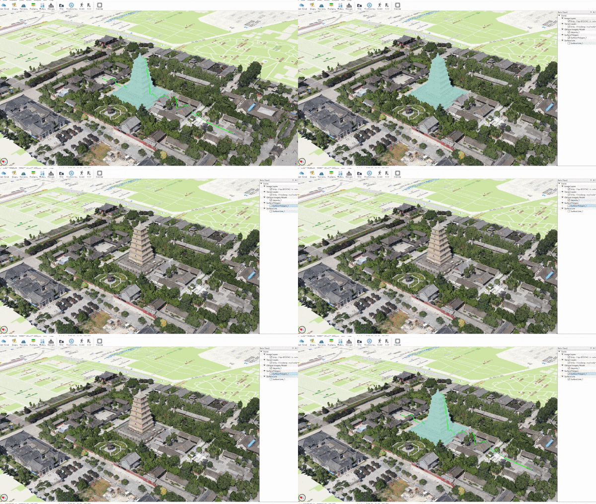
Oblique imagery models

image not available

image not available

Draw & measure

image not available

Data management

image not available

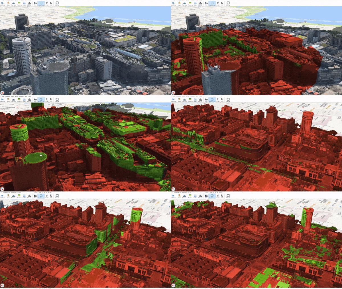
Visibility test

image not available

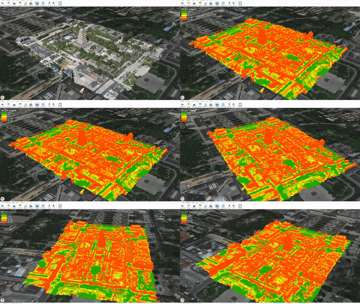
Slope grade visualization

image not available

Plan comparison (by editing oblique model and insert new models)

image not available

image not available

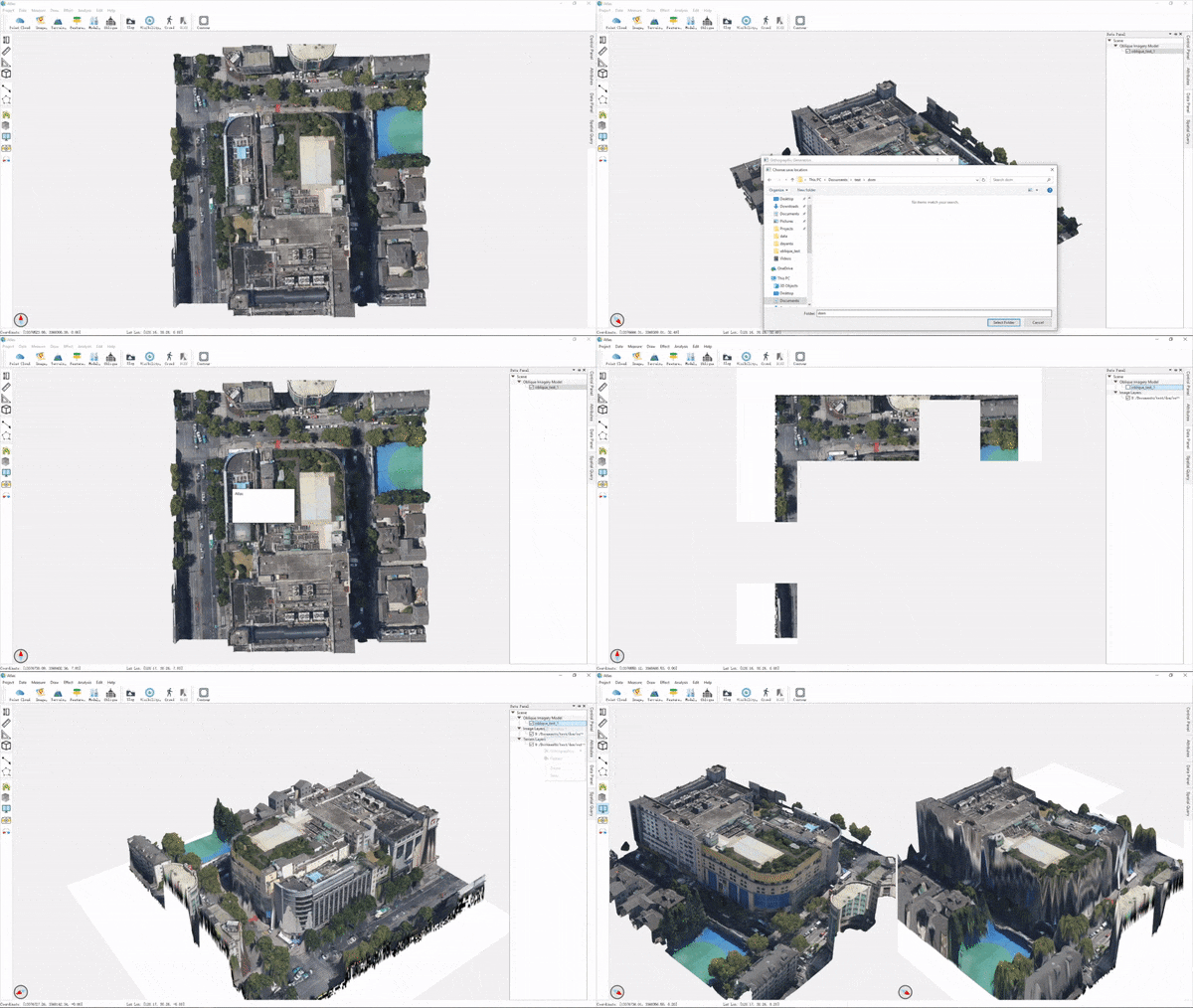
Orthographic generation (generate orthographic DOM and DSM for oblique model)

image not available

Contribute

This project is at a very early stage. The core code is far from being mature or stable, and the plugins need testing and maintenance. Also, since the project aims to mimic QGIS and Google Earth, more functionalities (plugins) are urgently and consistently needed.

If you are interested in or skilled at any of the following topics, we are most delightful if you can become a contributor:

  • skills: C++, Qt, OSG, OSGEarth, OpenGL
  • topics: desktop app, visualization, UI
  • research: GIS, CG, CV

Getting started

You can get started following these steps:

  1. try out the dev release
  2. build from source
  3. read the project structure
  4. find your interested task on trello board or put up a new idea
  5. fork the project, finish coding and commit a PR

If you want to write a new plugin, see plugin_guide.md.

Dev Resources

Contact

You are welcome to give feedbacks on issues page, or just contact us via [email protected].

We manage the project progress on trello where you can also request for features and report bugs.

atlas's People

Contributors

mola avatar tqjxlm avatar

Stargazers

 avatar  avatar  avatar  avatar  avatar  avatar  avatar  avatar  avatar  avatar  avatar  avatar  avatar  avatar  avatar  avatar  avatar  avatar  avatar  avatar  avatar  avatar  avatar  avatar  avatar  avatar  avatar  avatar  avatar  avatar  avatar  avatar  avatar  avatar  avatar  avatar  avatar  avatar  avatar  avatar  avatar  avatar  avatar  avatar  avatar  avatar  avatar  avatar  avatar  avatar  avatar  avatar  avatar  avatar  avatar  avatar  avatar  avatar  avatar  avatar  avatar  avatar  avatar  avatar  avatar  avatar  avatar  avatar  avatar  avatar  avatar  avatar  avatar  avatar  avatar  avatar  avatar  avatar  avatar  avatar  avatar  avatar  avatar  avatar  avatar  avatar  avatar  avatar  avatar  avatar  avatar  avatar  avatar  avatar  avatar  avatar  avatar  avatar  avatar  avatar

Watchers

 avatar  avatar  avatar  avatar  avatar  avatar  avatar  avatar  avatar  avatar  avatar  avatar  avatar  avatar

atlas's Issues

viewer hangs while importing feature data in .shp format

Describe the bug
while loading shape data over a country, viewer hangs and even GUI does not respond

To Reproduce
Steps to reproduce the behavior:

  1. Go to 'Features'
  2. Click on 'import local data in .shp format'
  3. Scroll down to '....'
  4. See error

Expected behavior
It shall load good amount of data or error shall be thrown or appropriate load message shall come..

logs file gives error of SRS xform not possible

CMake Error

FRIBIDI_LIBRARY NOTFOUND
my platform : Windows 10

Function can not work(osgearth 2.10)

I use osgearth 2.10+osg3.6.4, the program runs normally without any errors, but the add data function does not work, such as AddTMSData and so on. By the way, why do mapNode and mainMap define two (MAX_SUBVIEW), and what can it do?

Best regards for you!

CMake Error in CMakeLists.txt: "GDAL_INCLUDE_DIR-NOTFOUND"

Hello
I read your guide to building the project, but I did not understand what #Select Plugins meant, so I try cmake .. and I got this error.
I use ubuntu 20.04 and I installed all Dependencies.

-- The C compiler identification is GNU 9.4.0
-- The CXX compiler identification is GNU 9.4.0
-- Detecting C compiler ABI info
-- Detecting C compiler ABI info - done
-- Check for working C compiler: /usr/bin/cc - skipped
-- Detecting C compile features
-- Detecting C compile features - done
-- Detecting CXX compiler ABI info
-- Detecting CXX compiler ABI info - done
-- Check for working CXX compiler: /usr/bin/c++ - skipped
-- Detecting CXX compile features
-- Detecting CXX compile features - done
-- Found osgViewer: /usr/lib/x86_64-linux-gnu/libosgViewer.so  
-- Found osgGA: /usr/lib/x86_64-linux-gnu/libosgGA.so  
-- Found osgDB: /usr/lib/x86_64-linux-gnu/libosgDB.so  
-- Found osgManipulator: /usr/lib/x86_64-linux-gnu/libosgManipulator.so  
-- Found osgSim: /usr/lib/x86_64-linux-gnu/libosgSim.so  
-- Found osgParticle: /usr/lib/x86_64-linux-gnu/libosgParticle.so  
-- Found osgText: /usr/lib/x86_64-linux-gnu/libosgText.so  
-- Found osgUtil: /usr/lib/x86_64-linux-gnu/libosgUtil.so  
-- Found osg: /usr/lib/x86_64-linux-gnu/libosg.so  
-- Found OpenThreads: /usr/lib/x86_64-linux-gnu/libOpenThreads.so  
-- Found OpenSceneGraph: /usr/lib/x86_64-linux-gnu/libosgViewer.so;/usr/lib/x86_64-linux-gnu/libosgGA.so;/usr/lib/x86_64-linux-gnu/libosgDB.so;/usr/lib/x86_64-linux-gnu/libosgManipulator.so;/usr/lib/x86_64-linux-gnu/libosgSim.so;/usr/lib/x86_64-linux-gnu/libosgParticle.so;/usr/lib/x86_64-linux-gnu/libosgText.so;/usr/lib/x86_64-linux-gnu/libosgUtil.so;/usr/lib/x86_64-linux-gnu/libosg.so;/usr/lib/x86_64-linux-gnu/libOpenThreads.so (found suitable version "3.6.4", minimum required is "3.4.0") 
-- Could NOT find GDAL (missing: GDAL_LIBRARY GDAL_INCLUDE_DIR) (found version "GDAL_VERSION-NOTFOUND")
Defining plugin: AddArcGISData
Defining plugin: AddGDALData
Defining plugin: AddModel
Defining plugin: AddOGCData
Defining plugin: AddObliqueModel
Defining plugin: AddPointCloud
Defining plugin: AddTMSData
Defining plugin: AddXYZData
Defining plugin: CrowdSimulation
Defining plugin: DiffAnalysis
Defining plugin: DrawLine
Defining plugin: DrawPolygon
Defining plugin: DrawSurfaceLine
Defining plugin: DrawSurfacePolygon
Defining plugin: DrawVector
Defining plugin: EarthDataInterface
Defining plugin: Locator
Defining plugin: MeasureArea
Defining plugin: MeasureHeight
Defining plugin: MeasureLine
Defining plugin: MeasureTerrainArea
Defining plugin: MeasureTerrainVolume
Defining plugin: MeshMode
Defining plugin: ModelFlatten
Defining plugin: MultiView
Defining plugin: OpenSky-Network
Defining plugin: OrthoMap
Defining plugin: ScreenShot
Defining plugin: SetRefPlane
Defining plugin: ShowWeather
Defining plugin: SlopAnalysis
Defining plugin: Template
Defining plugin: TileSelect
Defining plugin: VRMode
Defining plugin: VisibilityTest
Defining plugin: VisibilityTestArea
-- Configuring done
CMake Error: The following variables are used in this project, but they are set to NOTFOUND.
Please set them or make sure they are set and tested correctly in the CMake files:
GDAL_INCLUDE_DIR (ADVANCED)
   used as include directory in directory /home/parisa/Projecs/Mola/Atlas
   used as include directory in directory /home/parisa/Projecs/Mola/Atlas
   used as include directory in directory /home/parisa/Projecs/Mola/Atlas
   used as include directory in directory /home/parisa/Projecs/Mola/Atlas
   used as include directory in directory /home/parisa/Projecs/Mola/Atlas
   used as include directory in directory /home/parisa/Projecs/Mola/Atlas
   used as include directory in directory /home/parisa/Projecs/Mola/Atlas
   used as include directory in directory /home/parisa/Projecs/Mola/Atlas/libs
   used as include directory in directory /home/parisa/Projecs/Mola/Atlas/libs
   used as include directory in directory /home/parisa/Projecs/Mola/Atlas/libs
   used as include directory in directory /home/parisa/Projecs/Mola/Atlas/libs
   used as include directory in directory /home/parisa/Projecs/Mola/Atlas/libs
   used as include directory in directory /home/parisa/Projecs/Mola/Atlas/libs
   used as include directory in directory /home/parisa/Projecs/Mola/Atlas/libs/CrowdSim
   used as include directory in directory /home/parisa/Projecs/Mola/Atlas/libs/CrowdSim
   used as include directory in directory /home/parisa/Projecs/Mola/Atlas/libs/CrowdSim
   used as include directory in directory /home/parisa/Projecs/Mola/Atlas/libs/CrowdSim
   used as include directory in directory /home/parisa/Projecs/Mola/Atlas/libs/CrowdSim
   used as include directory in directory /home/parisa/Projecs/Mola/Atlas/libs/CrowdSim
   used as include directory in directory /home/parisa/Projecs/Mola/Atlas/libs/CrowdSim
GDAL_LIBRARY (ADVANCED)
    linked by target "Atlas" in directory /home/parisa/Projecs/Mola/Atlas

CMake Error in CMakeLists.txt:
  Found relative path while evaluating include directories of "Atlas":

    "GDAL_INCLUDE_DIR-NOTFOUND"


CMake Error in libs/CrowdSim/CMakeLists.txt:
  Found relative path while evaluating include directories of "CrowdSim":

    "GDAL_INCLUDE_DIR-NOTFOUND"


CMake Error in CMakeLists.txt:
  Found relative path while evaluating include directories of "Atlas":

    "GDAL_INCLUDE_DIR-NOTFOUND"


CMake Error in libs/CrowdSim/CMakeLists.txt:
  Found relative path while evaluating include directories of "CrowdSim":

    "GDAL_INCLUDE_DIR-NOTFOUND"


-- Generating done
CMake Generate step failed.  Build files cannot be regenerated correctly.


Screenshot from 2022-06-27 18-40-38

Could you please help me to build and run it?

VR mode issue

I download dev release,but the VR mode doesn't work!

What i dit is as follows:

  1. open Atlas.exe
  2. switch to 3D mode
  3. click effect-VR mode

Than the SteamVR running,and a console windows appear and disappear Immediately!
By the way,i use HTC VIVE.

MSB3073 error on orthomap release build

Describe the bug
I could successfully build it in debug mode but in release mode- orthomap app I am facing xcopy related error

Screenshots
If applicable, add screenshots to help explain your problem.
image

Building issue

HI,
Im trying to build atlas under Win7 X64+ VS2017. I have bulit the ALL_BUILD project ,but issues come when I run the atlas program. When loading the CrowdSimulation plugin, exception will be throwed as the picture showed. It seems that the osgDB::readNodeFile always returns a null value. How can I solve it? Im looking forward for your advice.
Clark
QQ浏览器截图20190714231719
QQ浏览器截图20190714232609

On the UI page, when I chose to import point cloud, I imported a las file but nothing happens. Can this program load new point cloud data or it doesn't have this function?

Describe the bug
A clear and concise description of what the bug is.

To Reproduce
Steps to reproduce the behavior:

  1. Go to '...'
  2. Click on '....'
  3. Scroll down to '....'
  4. See error

Expected behavior
A clear and concise description of what you expected to happen.

Screenshots
If applicable, add screenshots to help explain your problem.

Environment (please complete the following information):

  • OS: [e.g. Windows 10 1803]
  • Version [e.g. 0.0.1]

Log file
If necessary, upload or paste your whole log file. You can find it at

  • Windows : C:\Users$username\AppData\Roaming\Atlas\Atlas\AtlasLog.txt
  • *nix : /tmp/Atlas/Atlas/AtlasLog.txt

Could you give a short video tutorial about how to use Atlas UI? Or is there any samples for the data to be loaded?

Describe the bug
A clear and concise description of what the bug is.

To Reproduce
Steps to reproduce the behavior:

  1. Go to '...'
  2. Click on '....'
  3. Scroll down to '....'
  4. See error

Expected behavior
A clear and concise description of what you expected to happen.

Screenshots
If applicable, add screenshots to help explain your problem.

Environment (please complete the following information):

  • OS: [e.g. Windows 10 1803]
  • Version [e.g. 0.0.1]

Log file
If necessary, upload or paste your whole log file. You can find it at

  • Windows : C:\Users$username\AppData\Roaming\Atlas\Atlas\AtlasLog.txt
  • *nix : /tmp/Atlas/Atlas/AtlasLog.txt

Moon , Mars globe similar to earth

Is your feature request related to a problem? Please describe.
I wish to add Mars and Moon disk similar to earth .. How to do this ?

Describe the solution you'd like
There may be two more menu items for switching to mars / moon visualization

Describe alternatives you've considered
There are possibility of different exe for mars , moon and earth.

Additional context
I wish to get full documentation of project structure

regards,
Jai

Recommend Projects

  • React photo React

    A declarative, efficient, and flexible JavaScript library for building user interfaces.

  • Vue.js photo Vue.js

    🖖 Vue.js is a progressive, incrementally-adoptable JavaScript framework for building UI on the web.

  • Typescript photo Typescript

    TypeScript is a superset of JavaScript that compiles to clean JavaScript output.

  • TensorFlow photo TensorFlow

    An Open Source Machine Learning Framework for Everyone

  • Django photo Django

    The Web framework for perfectionists with deadlines.

  • D3 photo D3

    Bring data to life with SVG, Canvas and HTML. 📊📈🎉

Recommend Topics

  • javascript

    JavaScript (JS) is a lightweight interpreted programming language with first-class functions.

  • web

    Some thing interesting about web. New door for the world.

  • server

    A server is a program made to process requests and deliver data to clients.

  • Machine learning

    Machine learning is a way of modeling and interpreting data that allows a piece of software to respond intelligently.

  • Game

    Some thing interesting about game, make everyone happy.

Recommend Org

  • Facebook photo Facebook

    We are working to build community through open source technology. NB: members must have two-factor auth.

  • Microsoft photo Microsoft

    Open source projects and samples from Microsoft.

  • Google photo Google

    Google ❤️ Open Source for everyone.

  • D3 photo D3

    Data-Driven Documents codes.